RCAT

CRB R-CAT Map Atlas

R-CAT: Riparian Condition Assessment Toolbox‎ > ‎R-CAT Applications‎ > ‎‎Columbia River Basin (CRB) Implementation‎ > ‎

CRB R-CAT Map Atlas

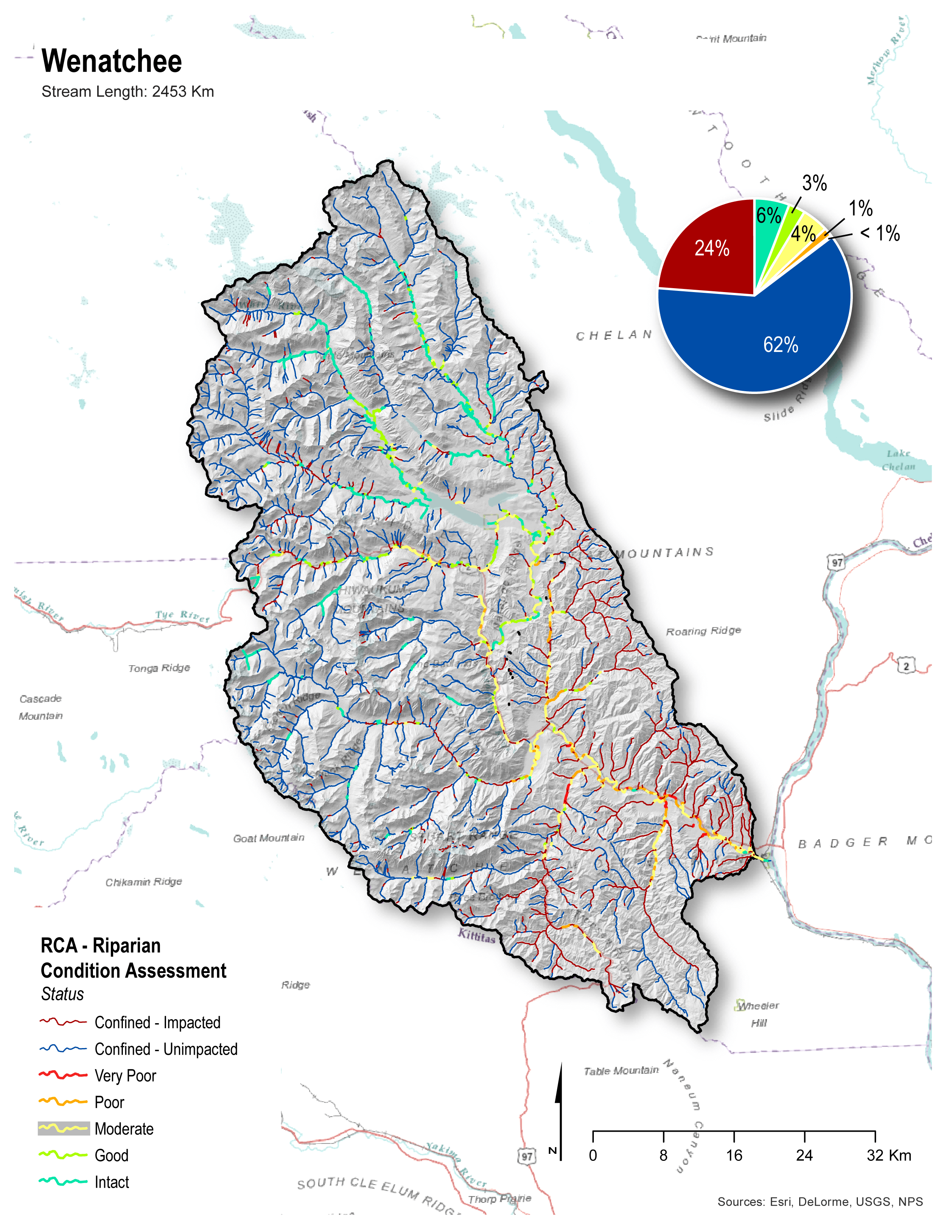
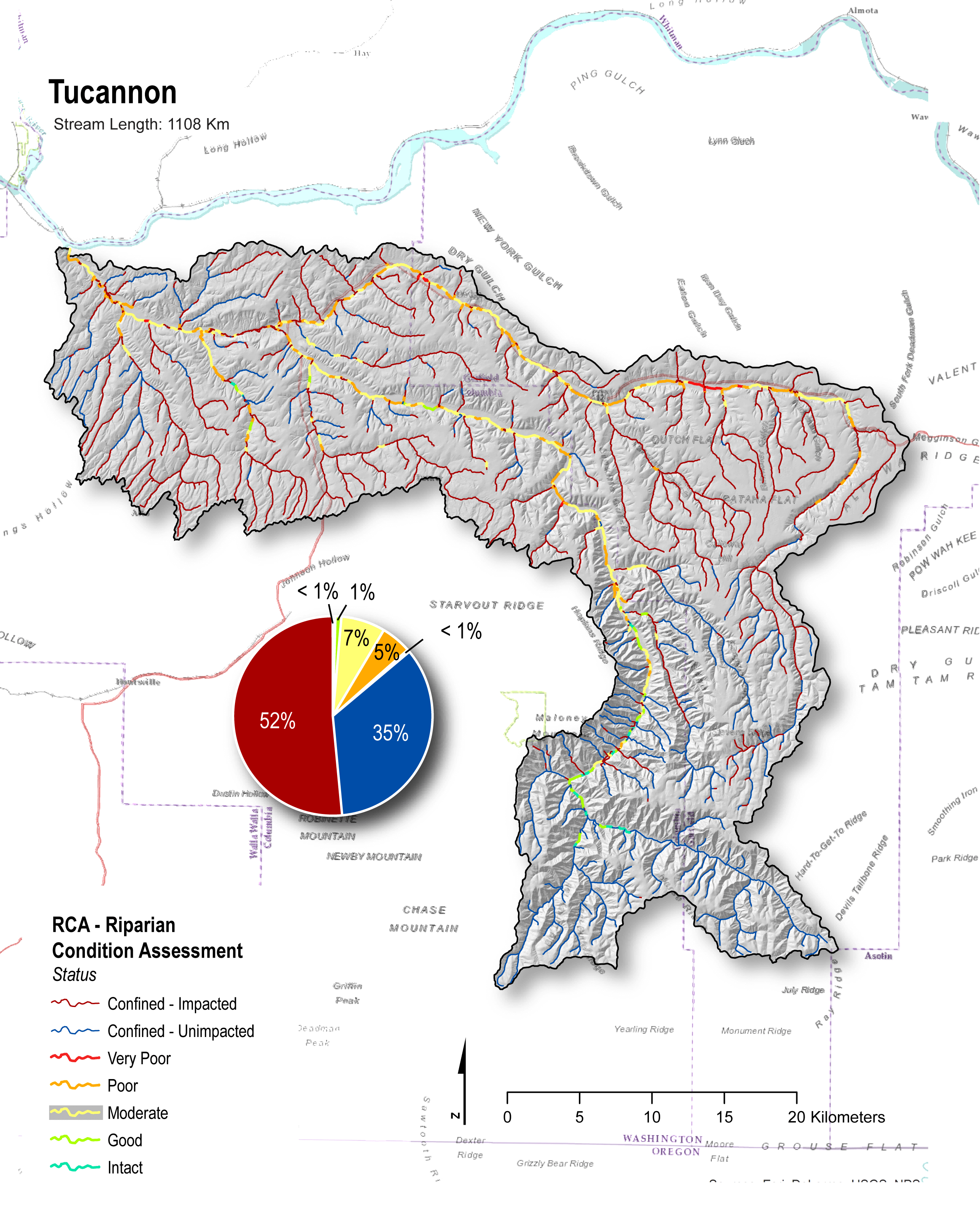
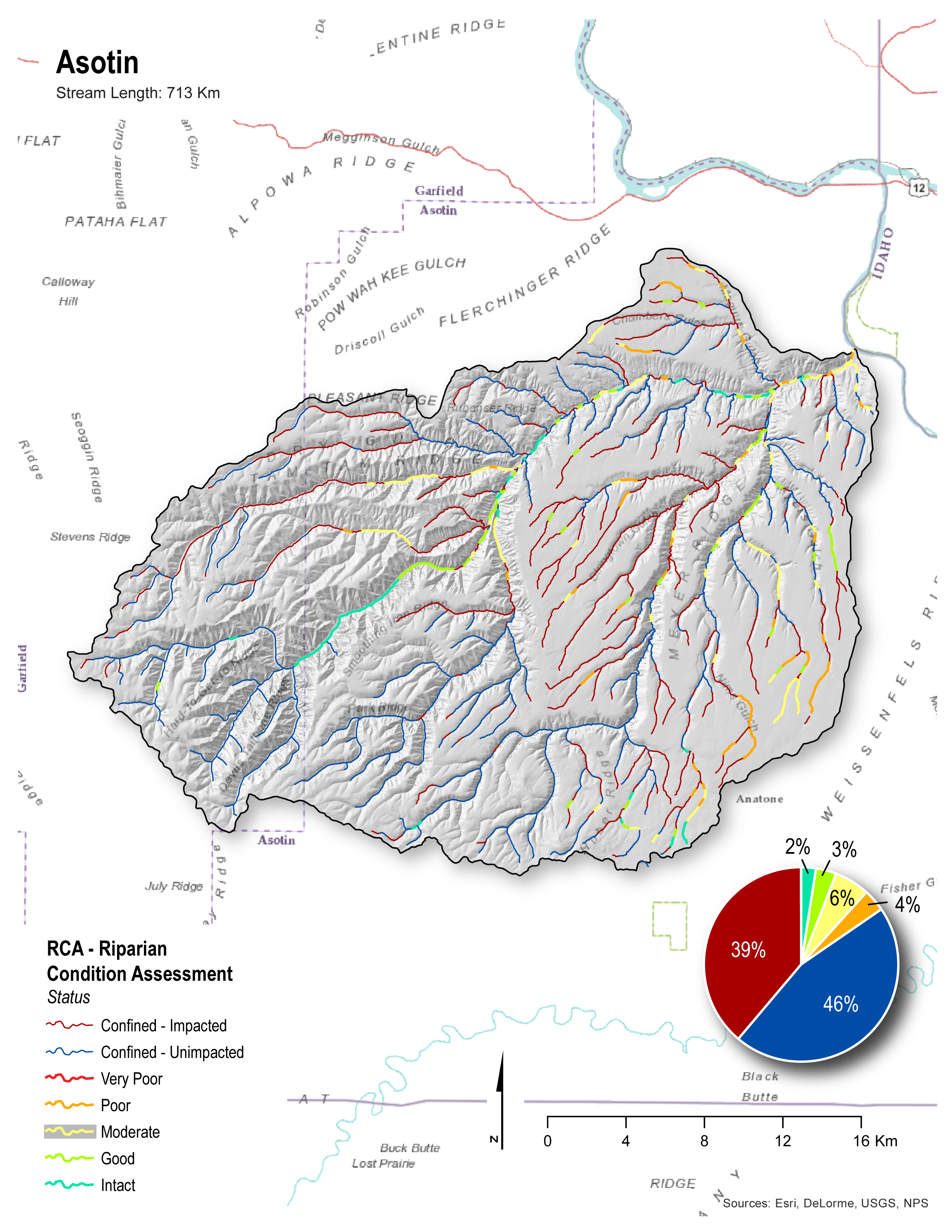
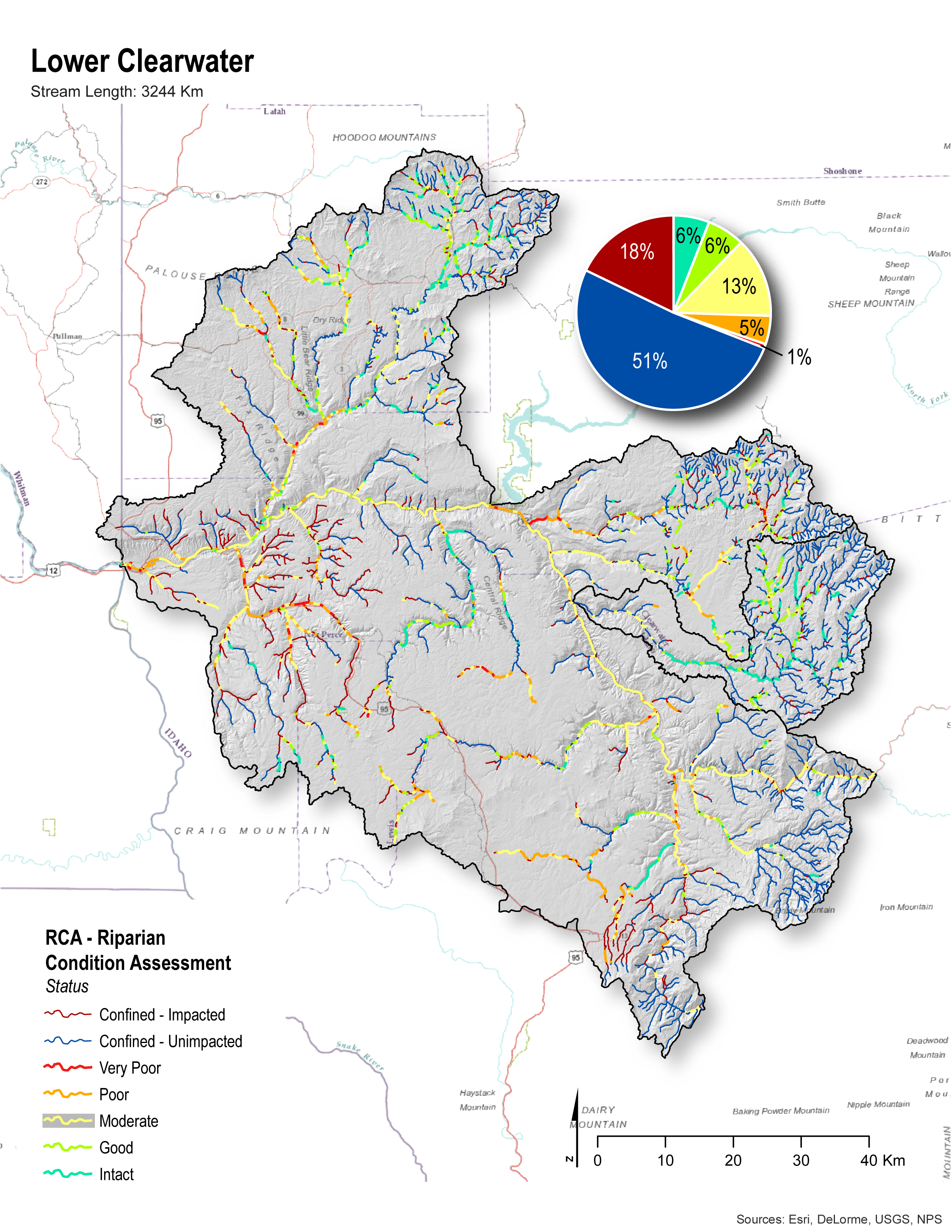
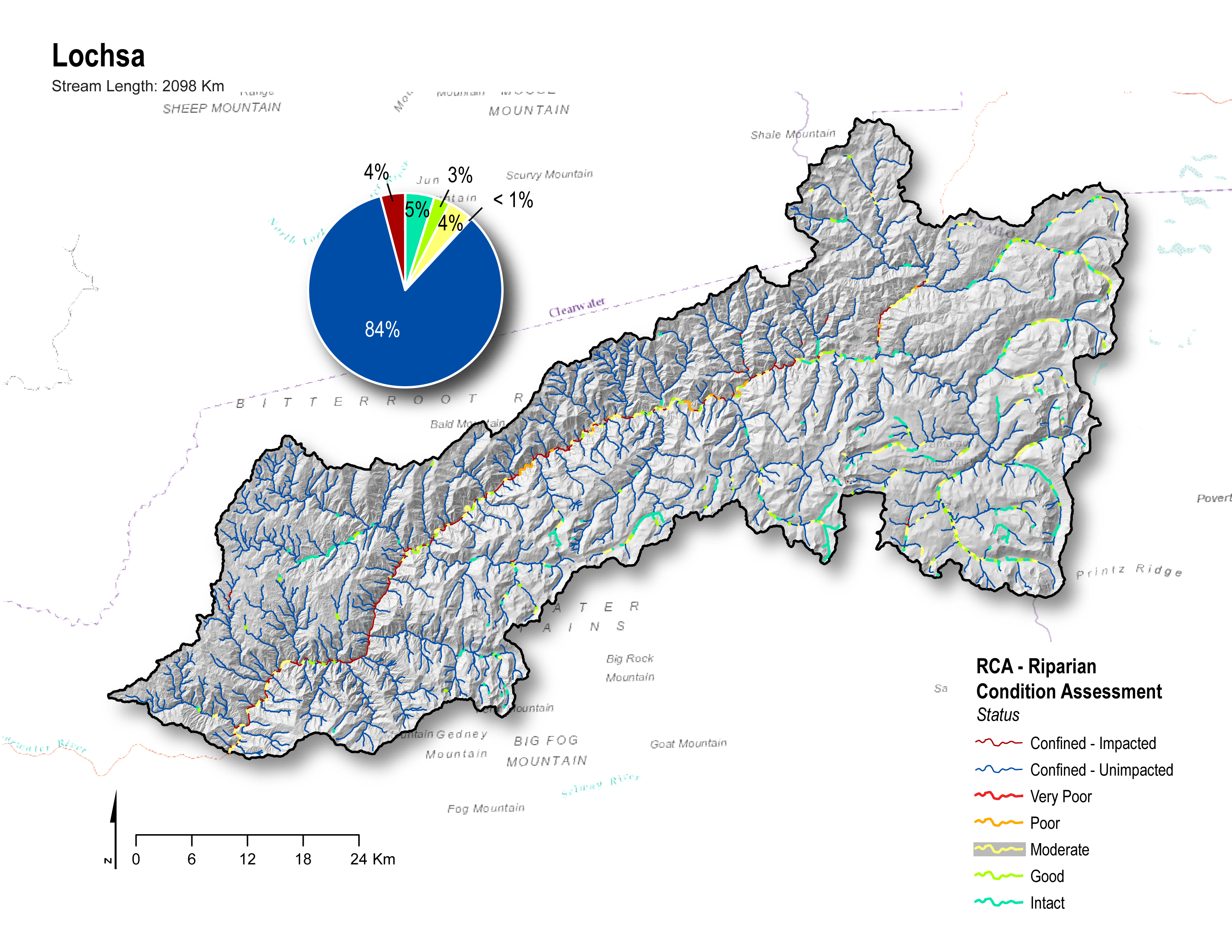
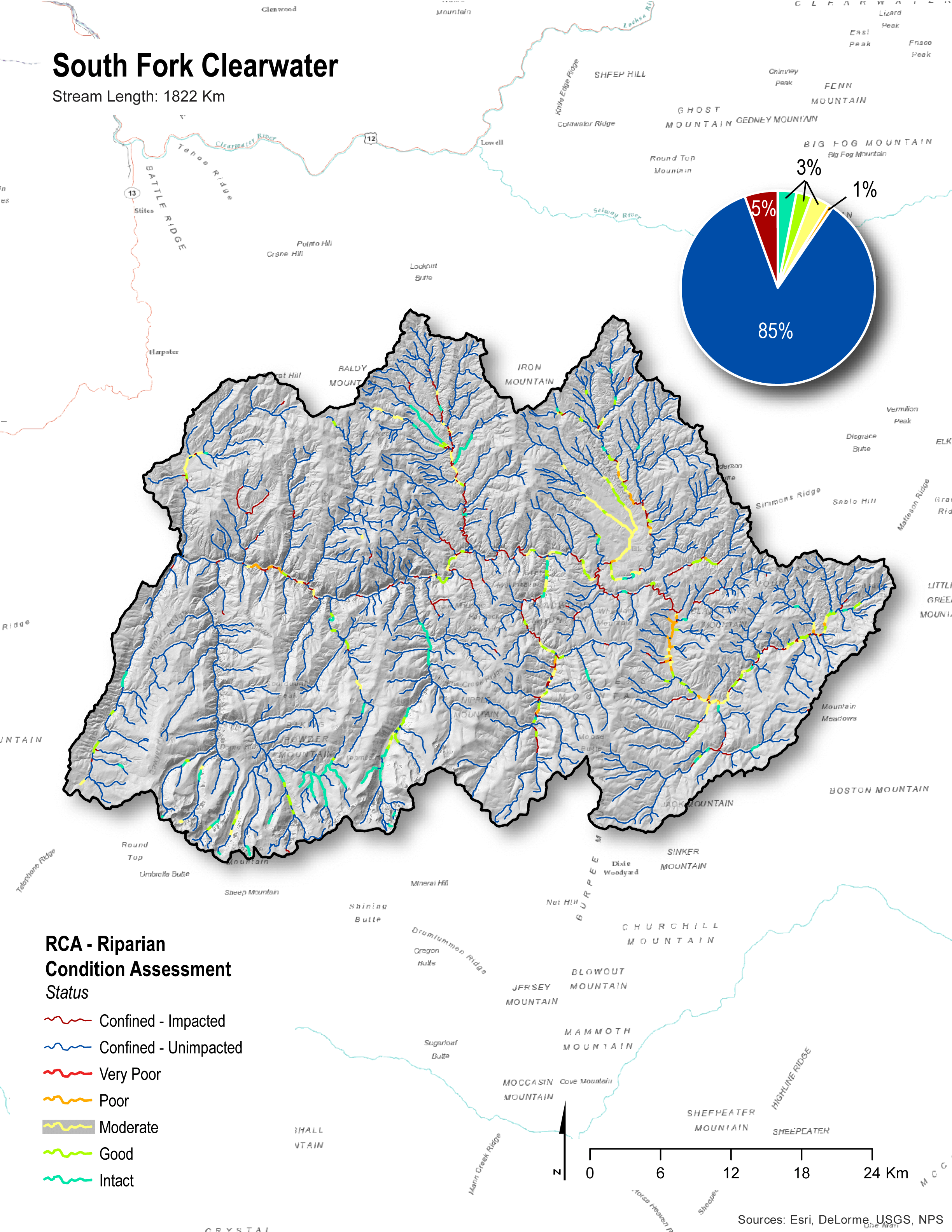
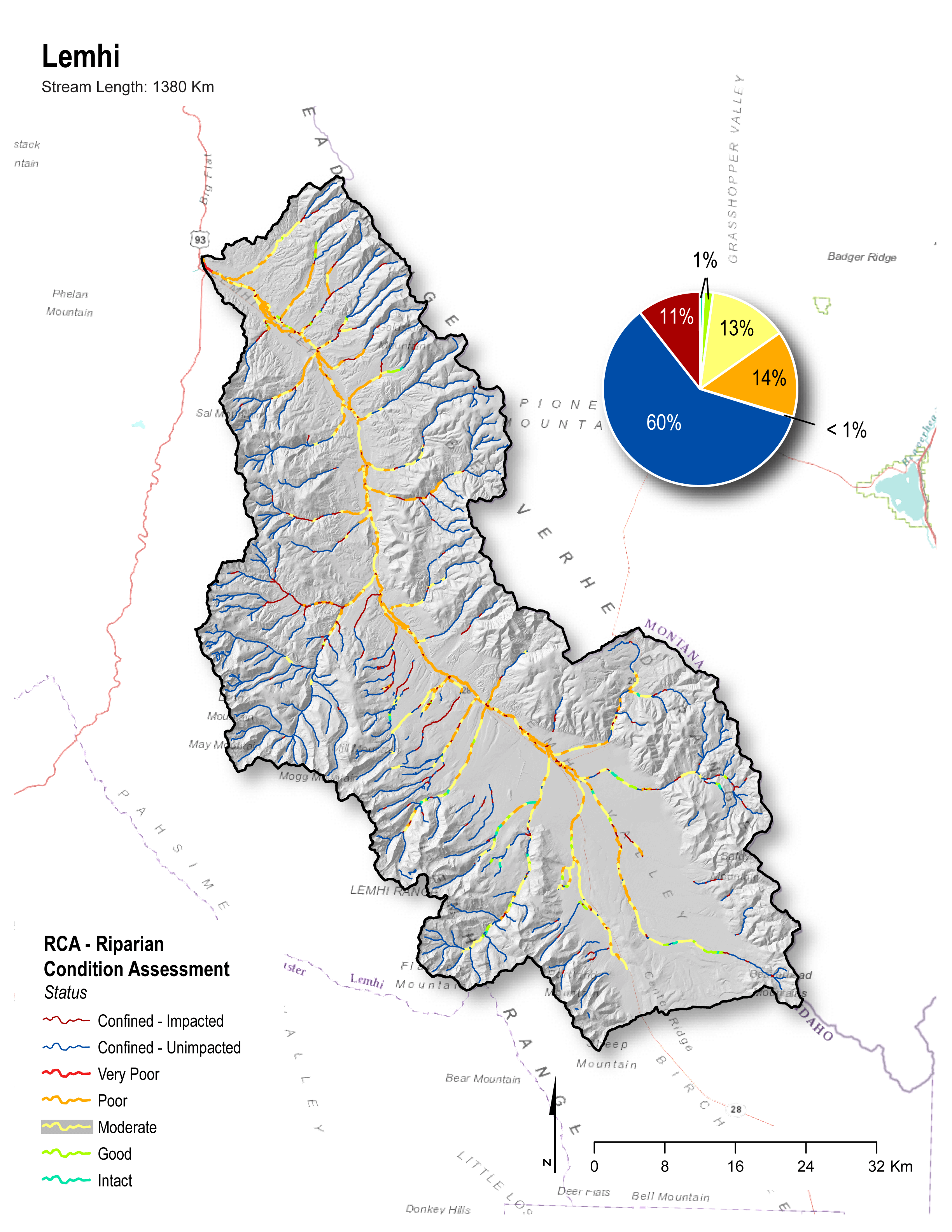
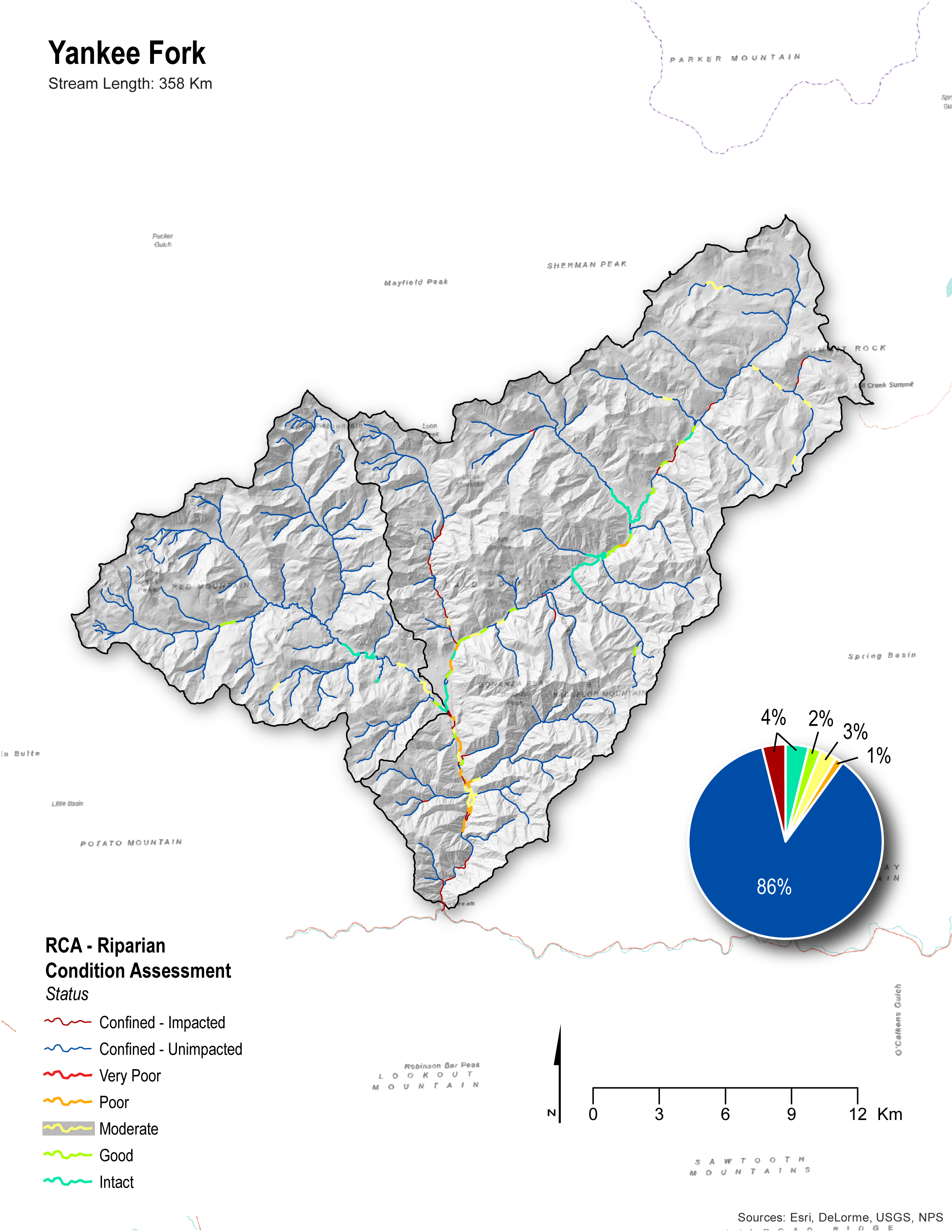
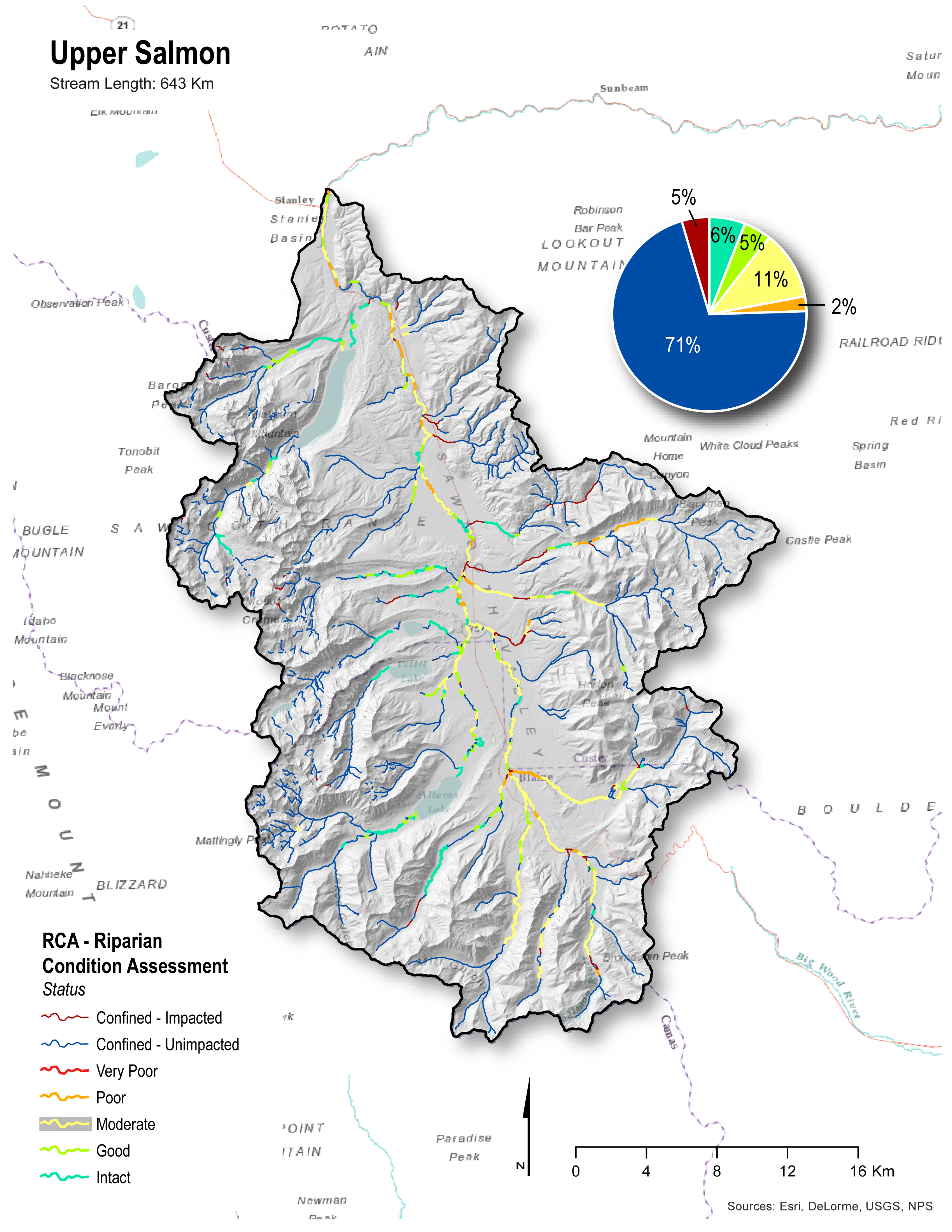
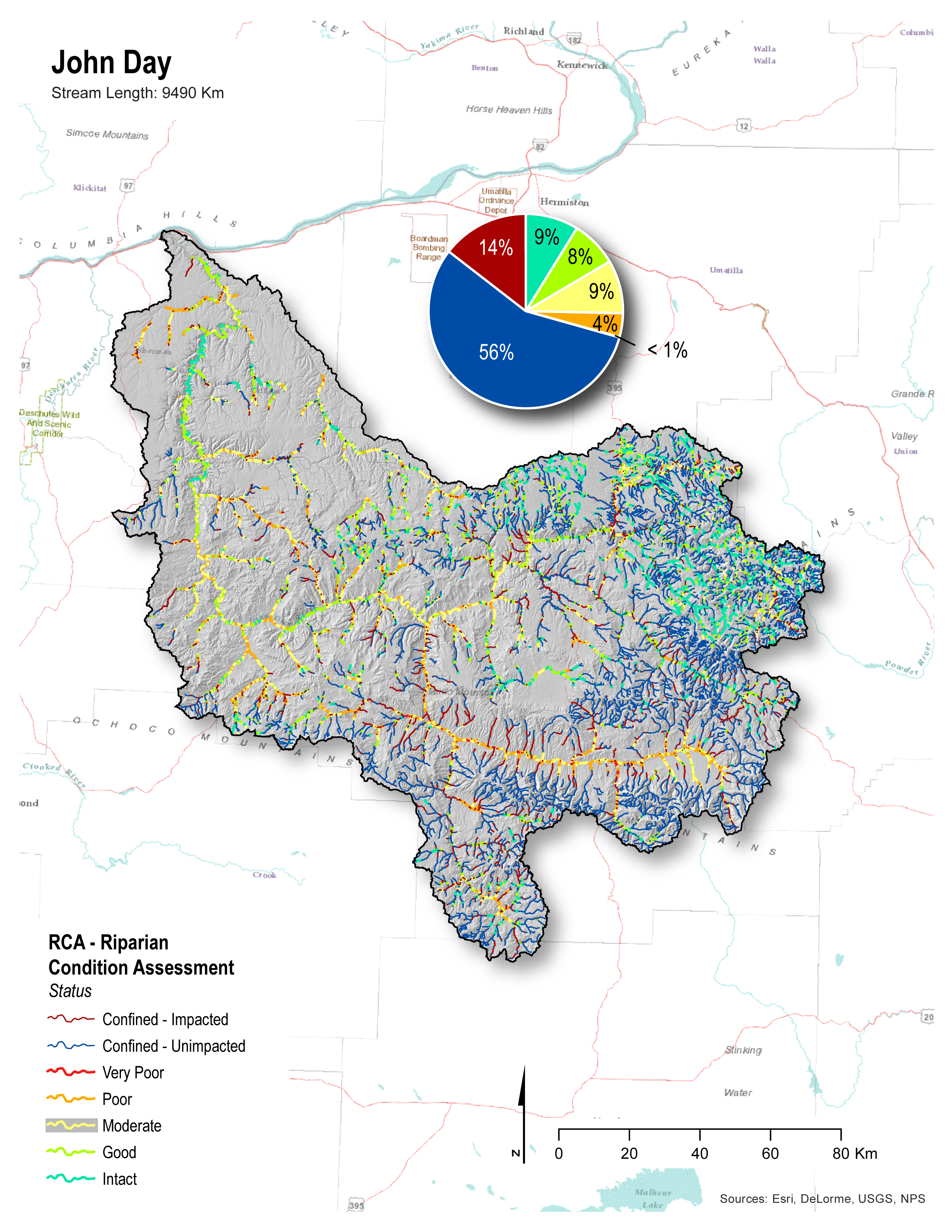
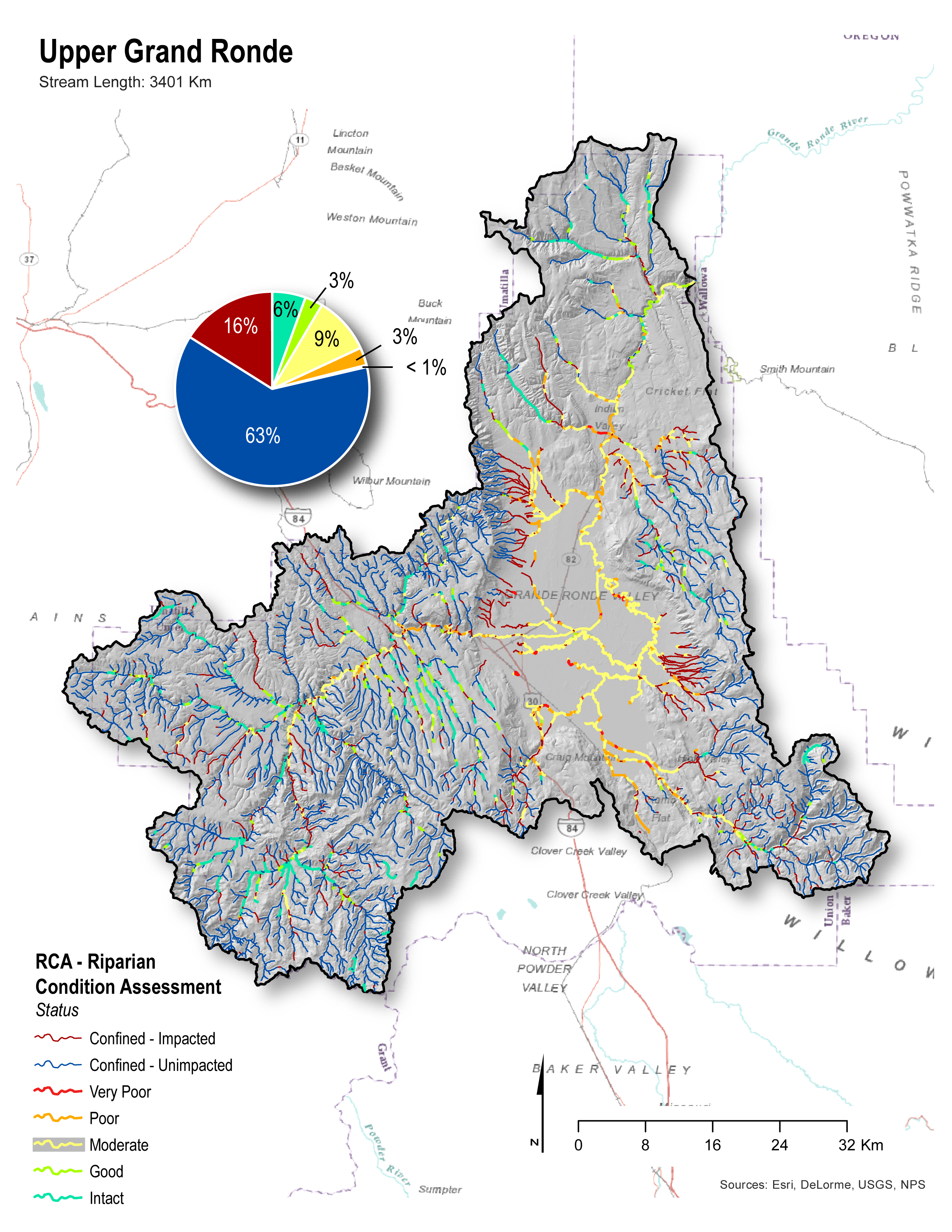
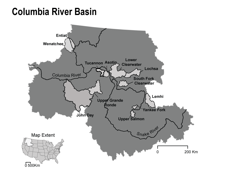
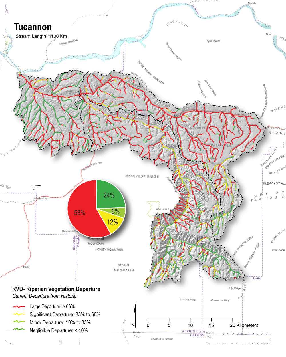
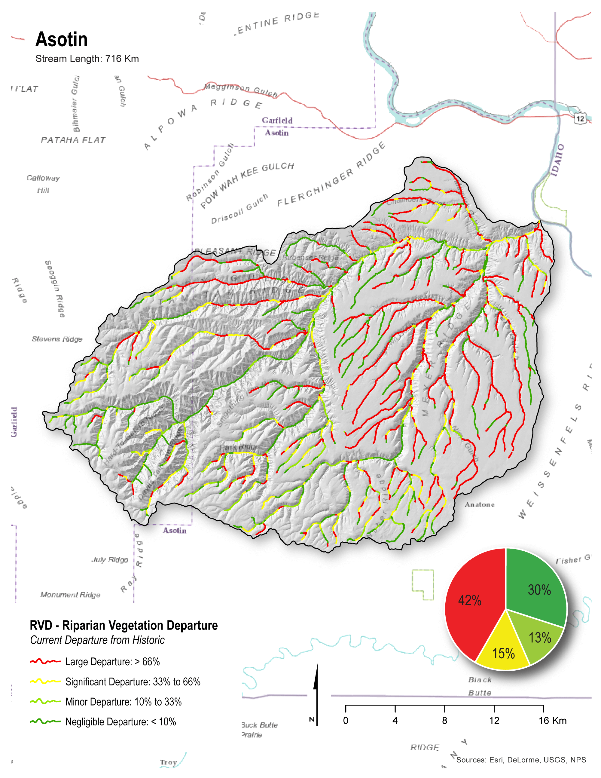
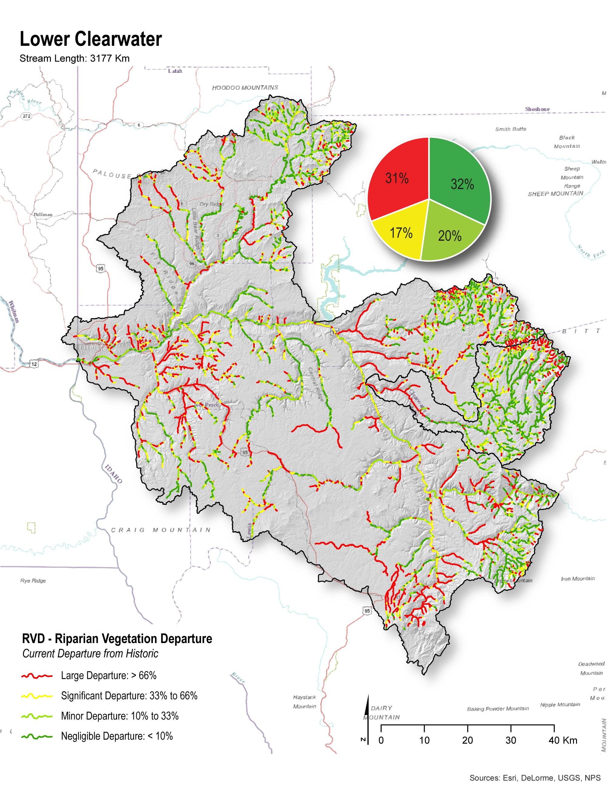
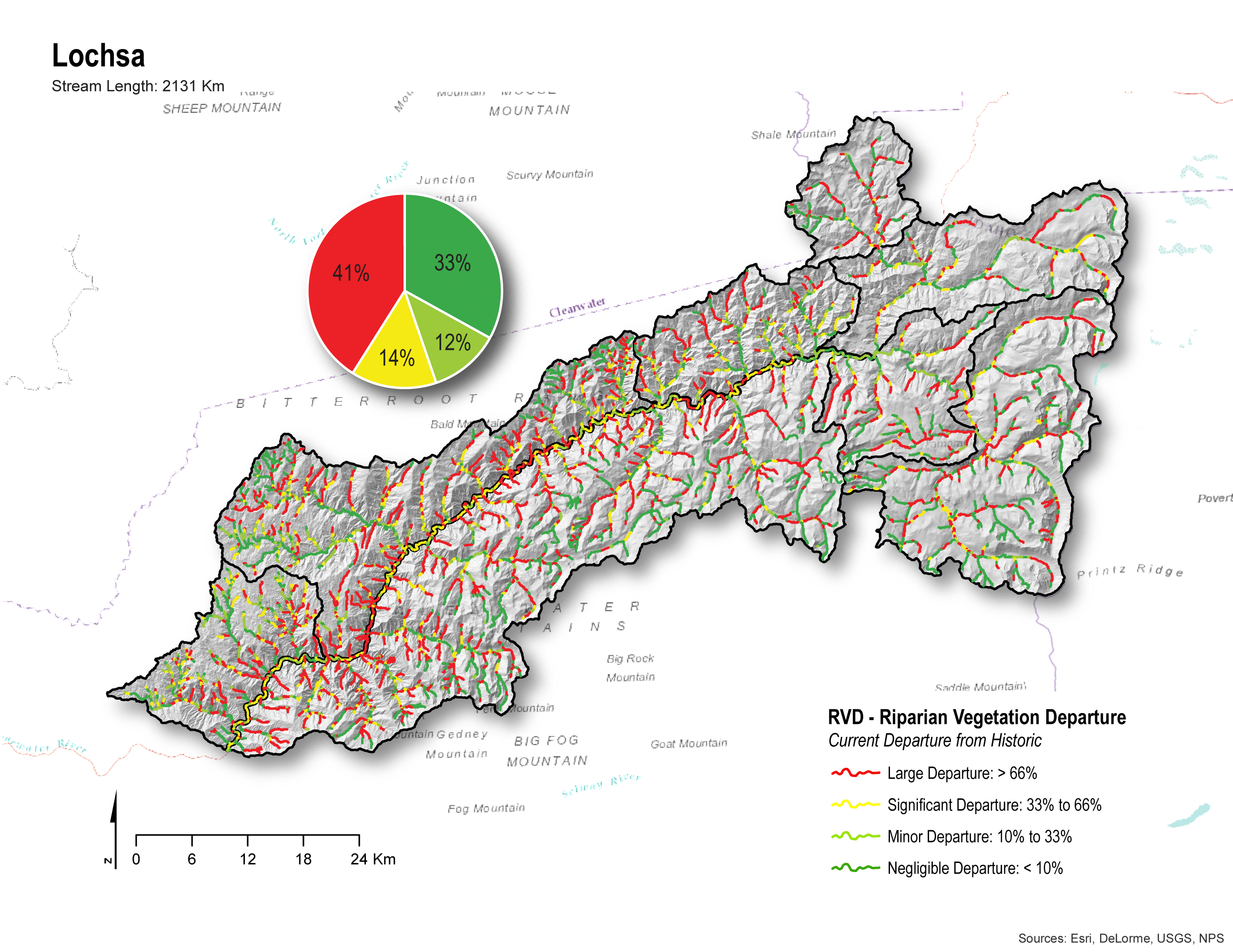
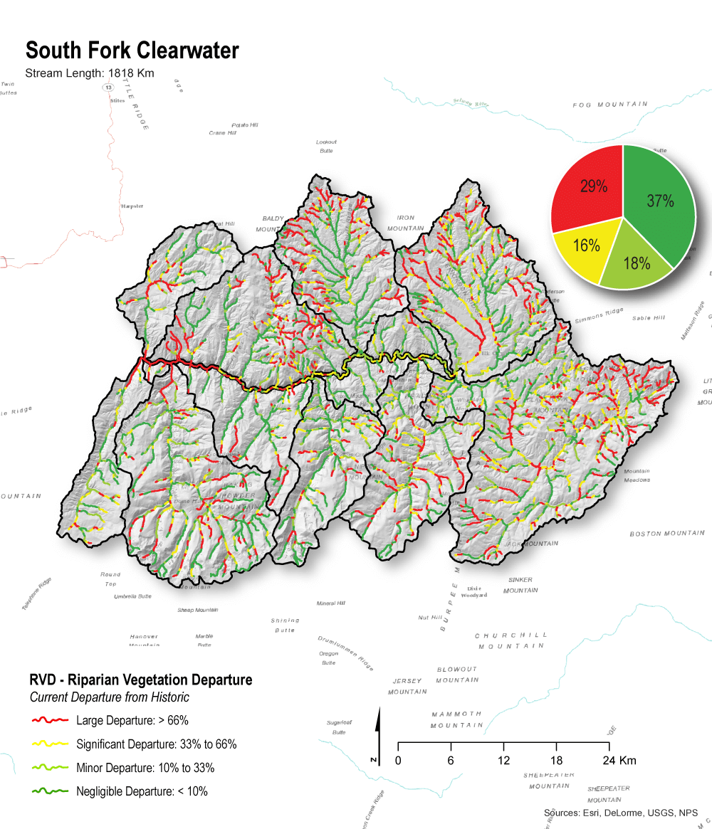
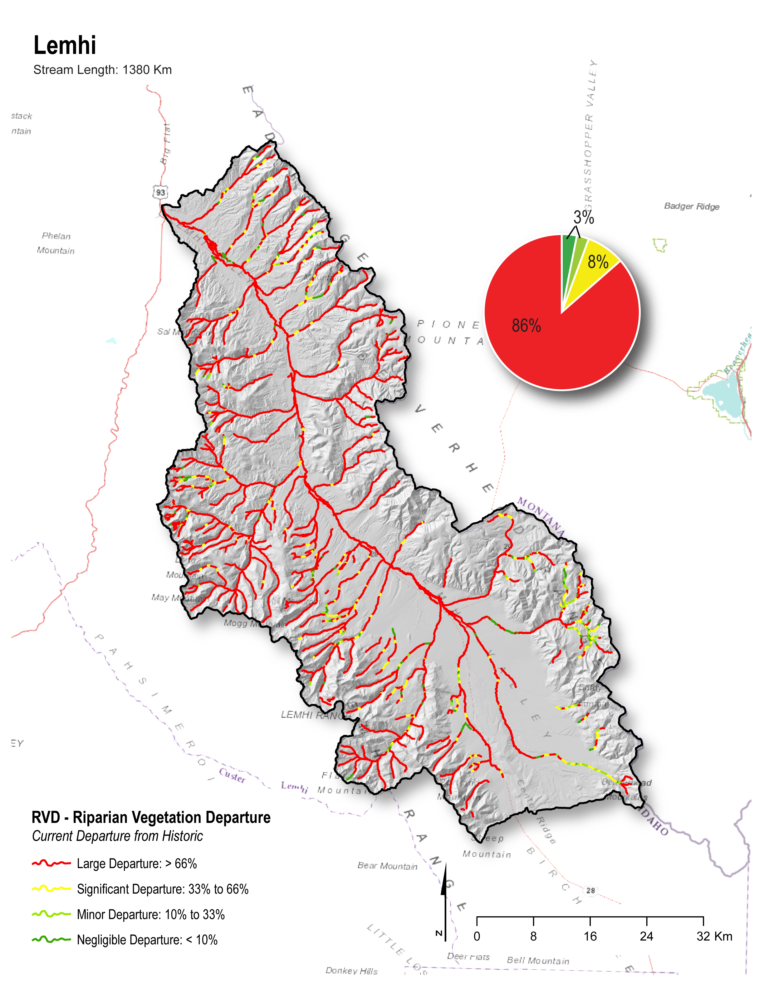
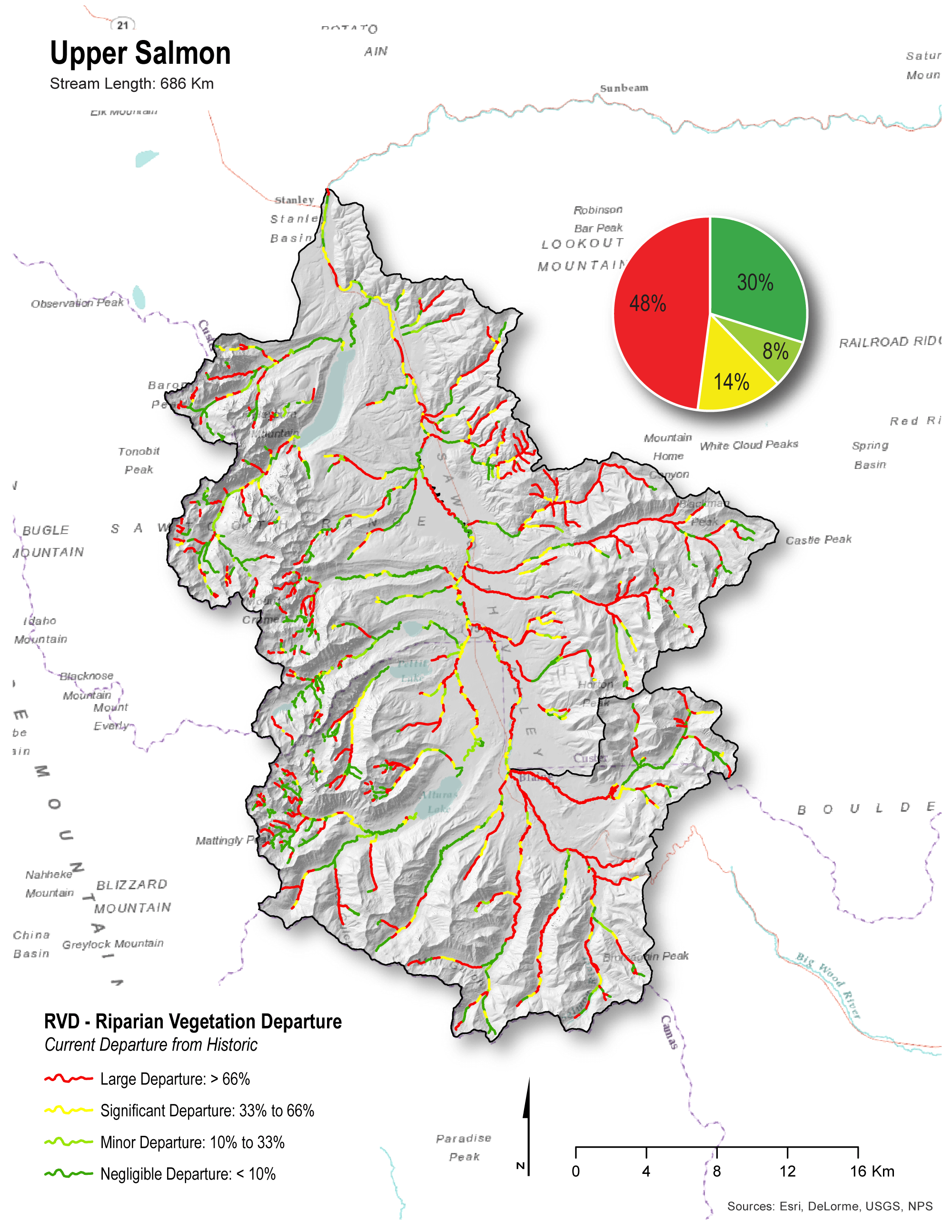
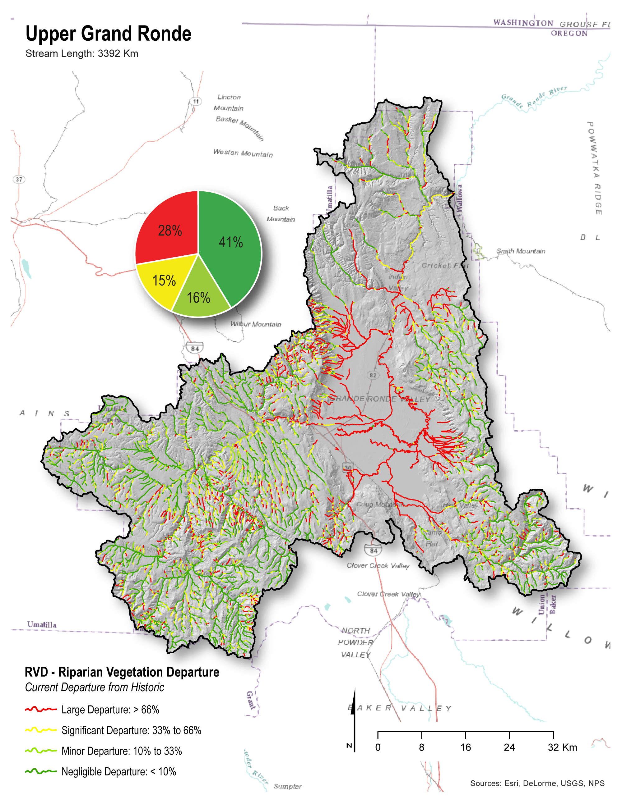
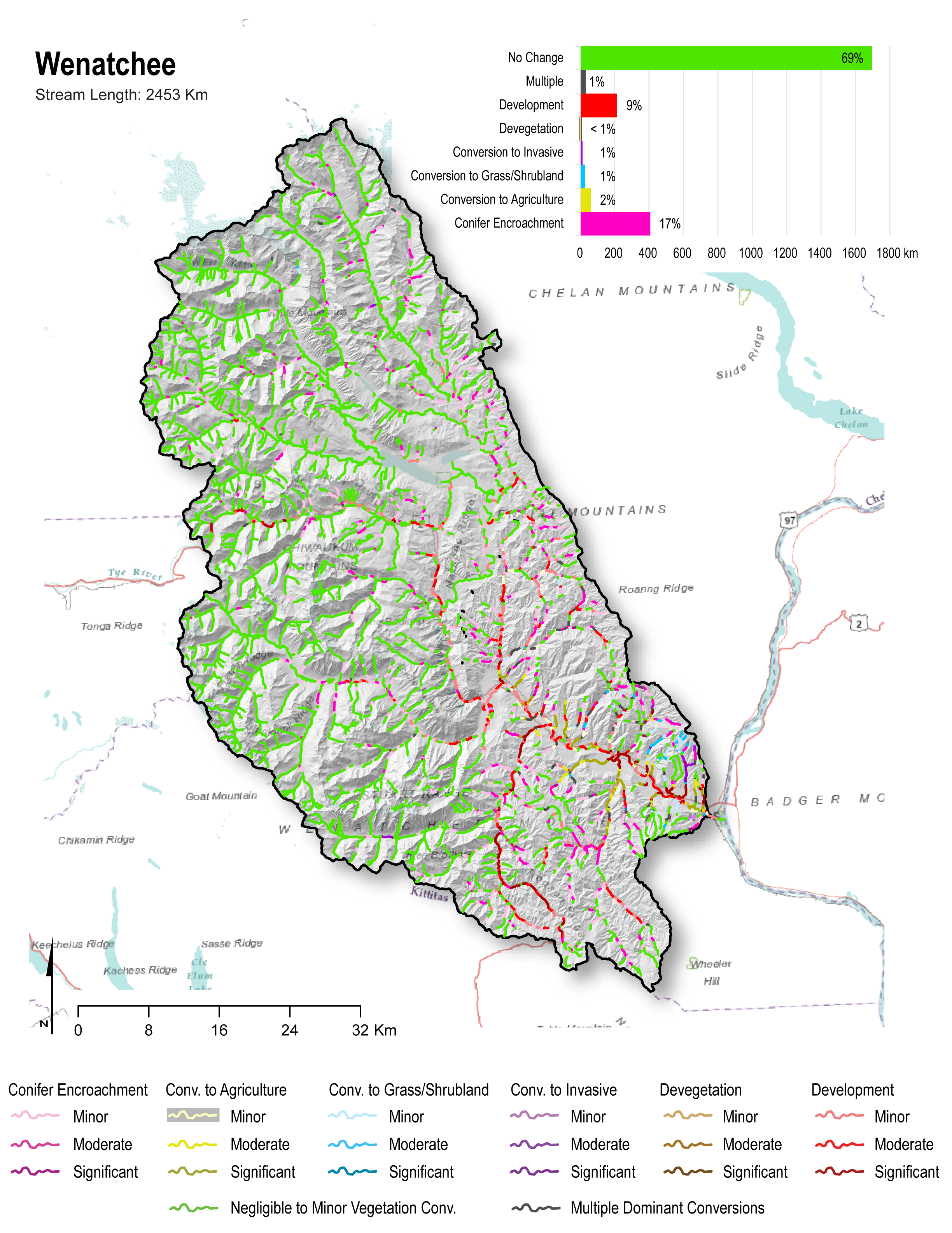
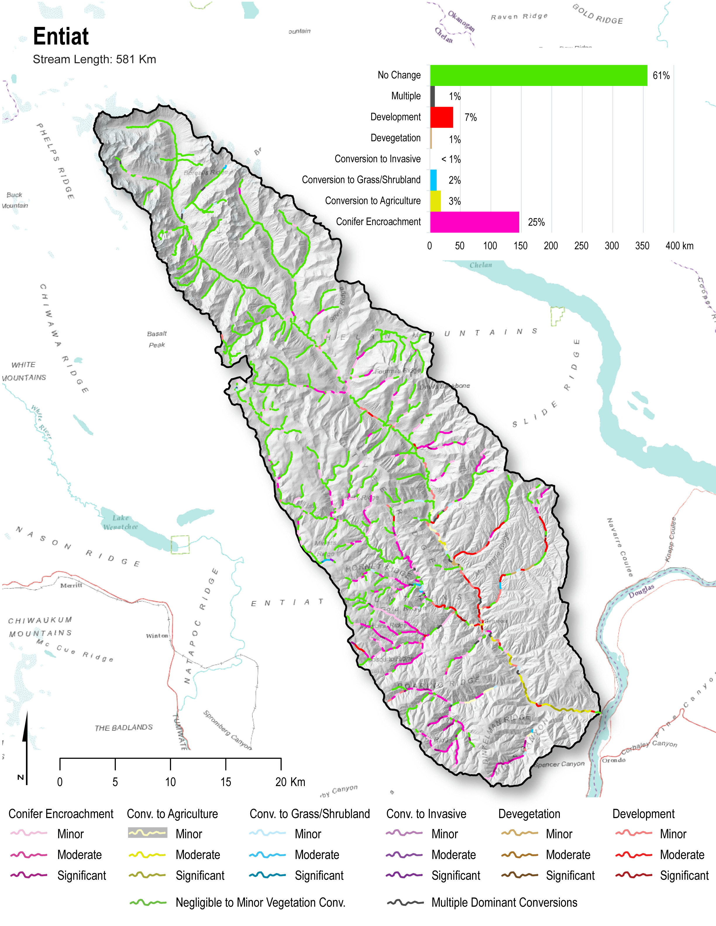
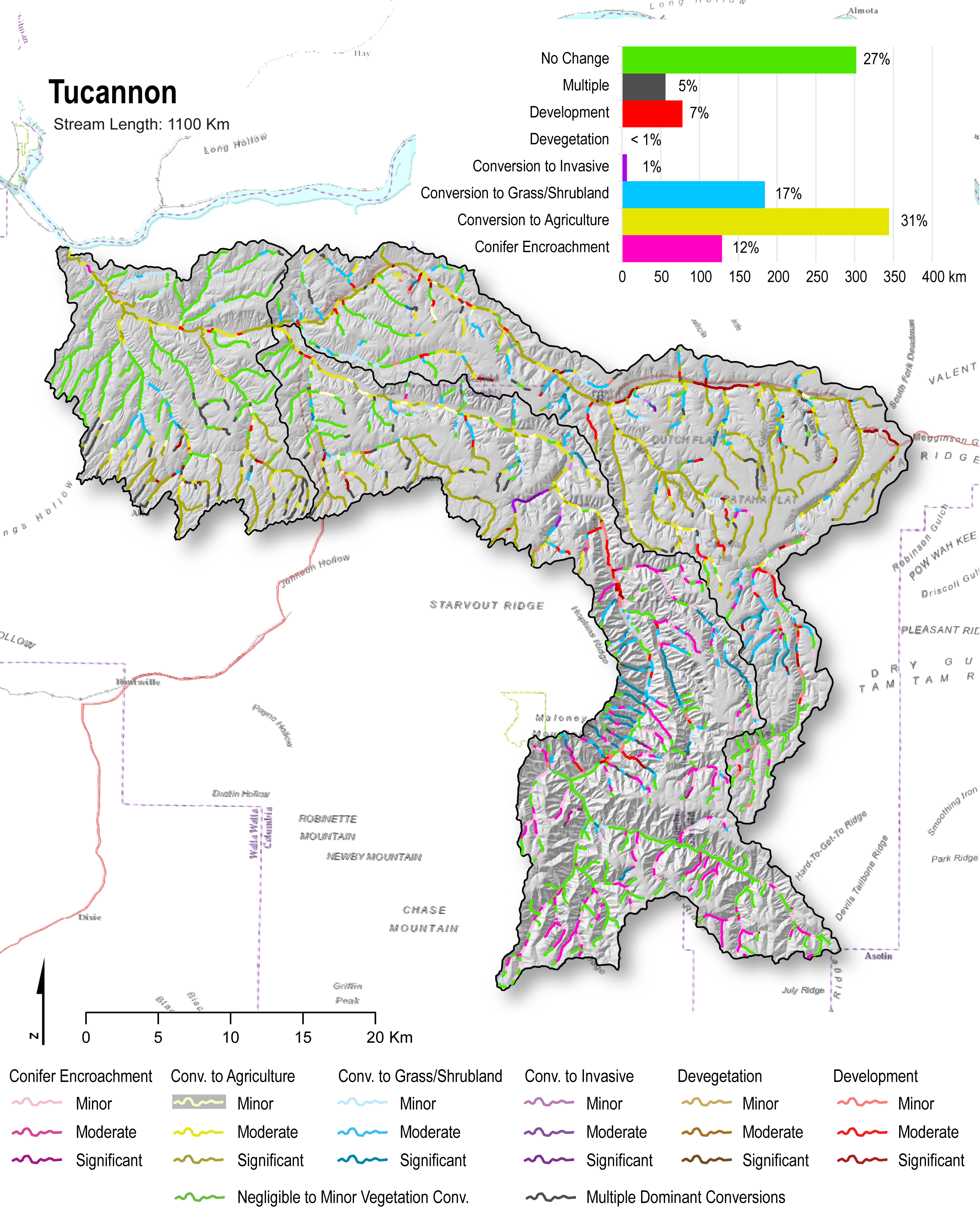
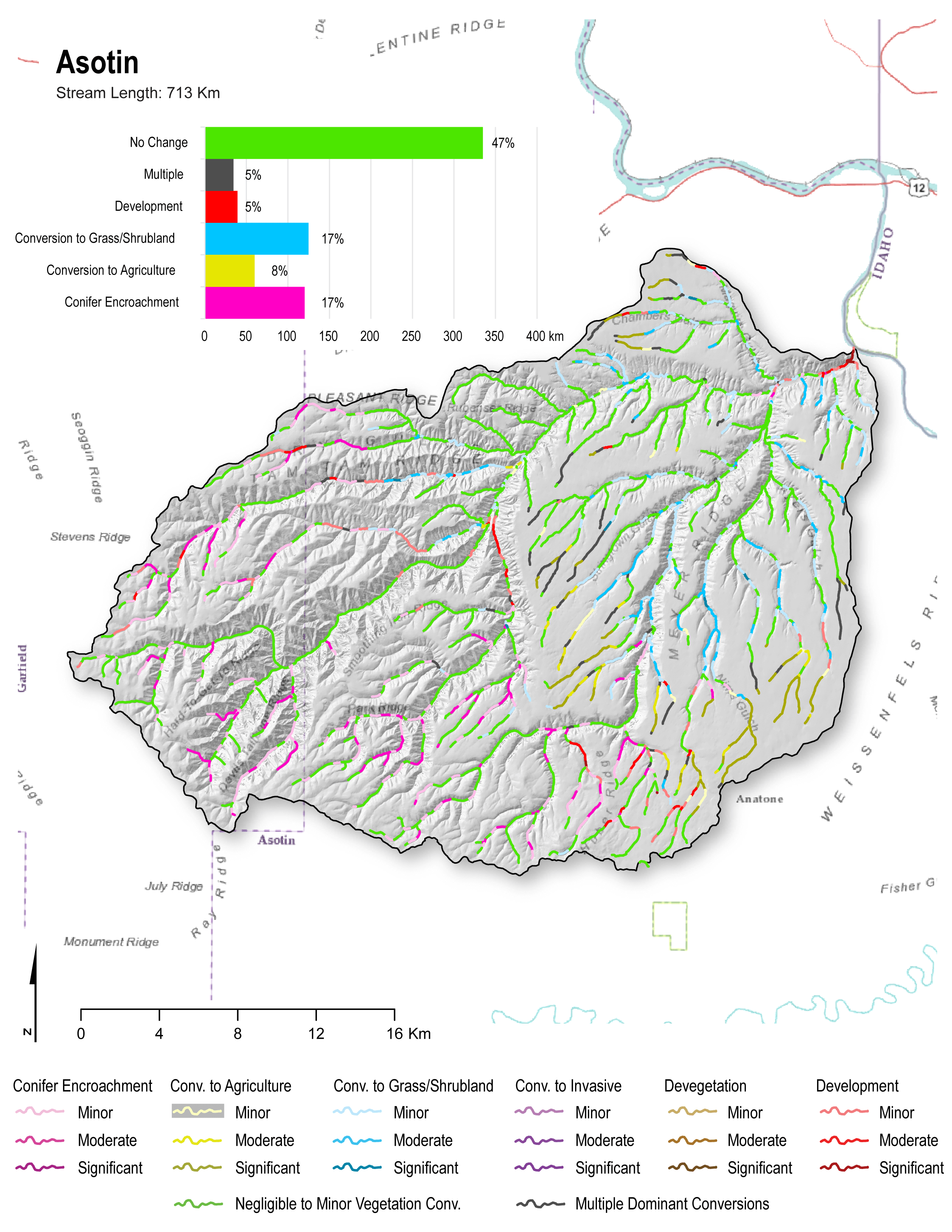
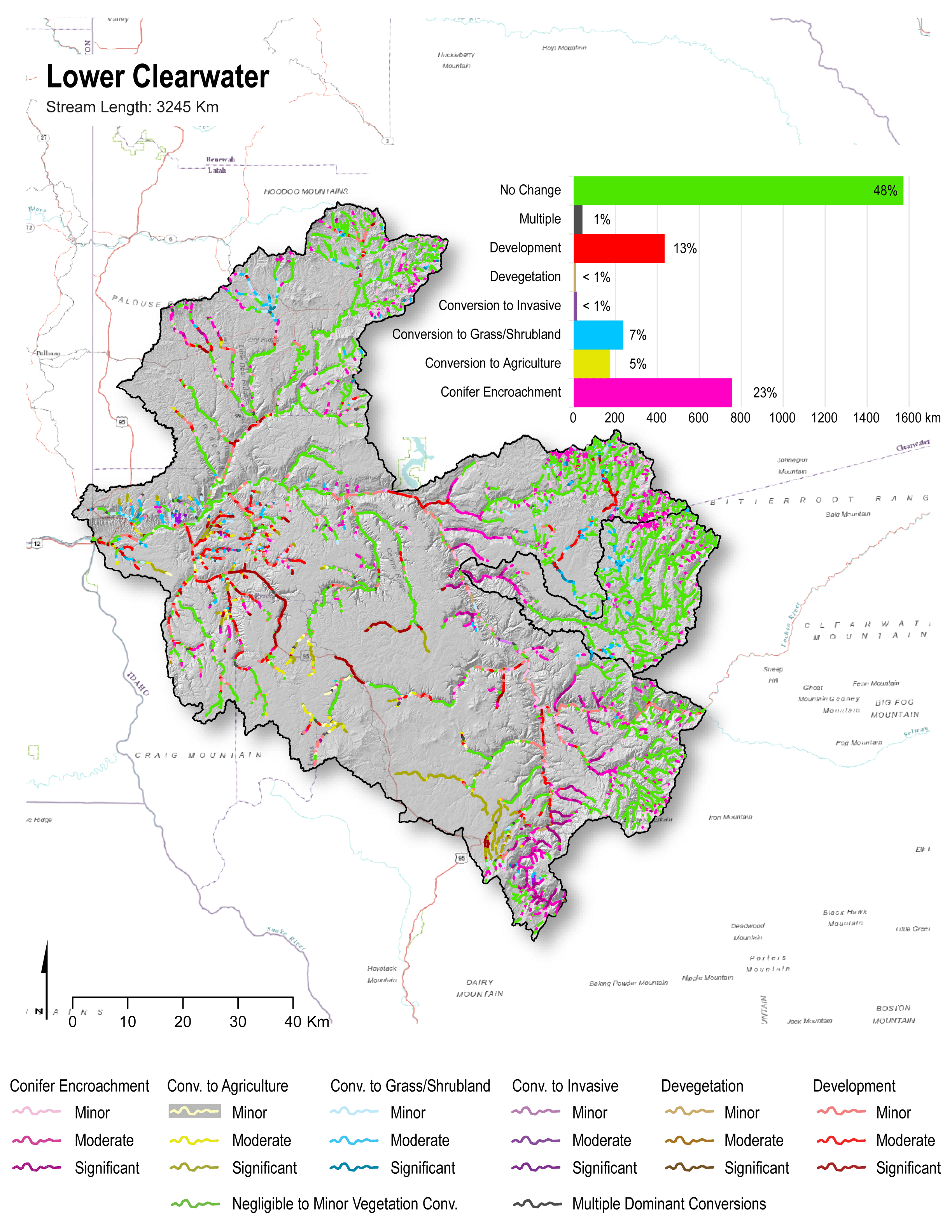
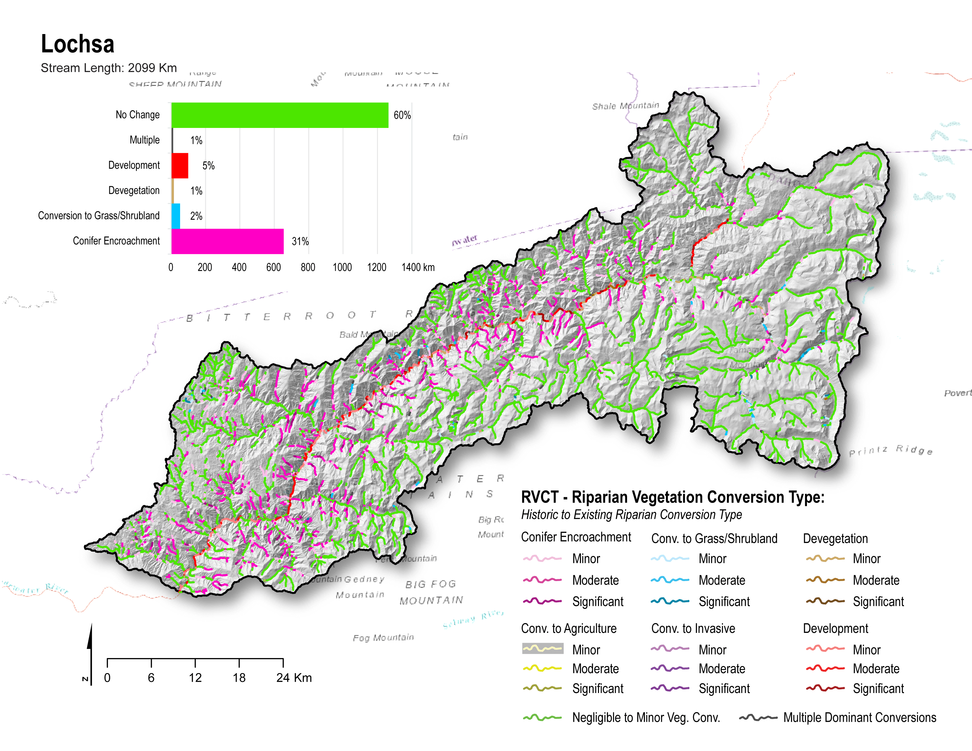
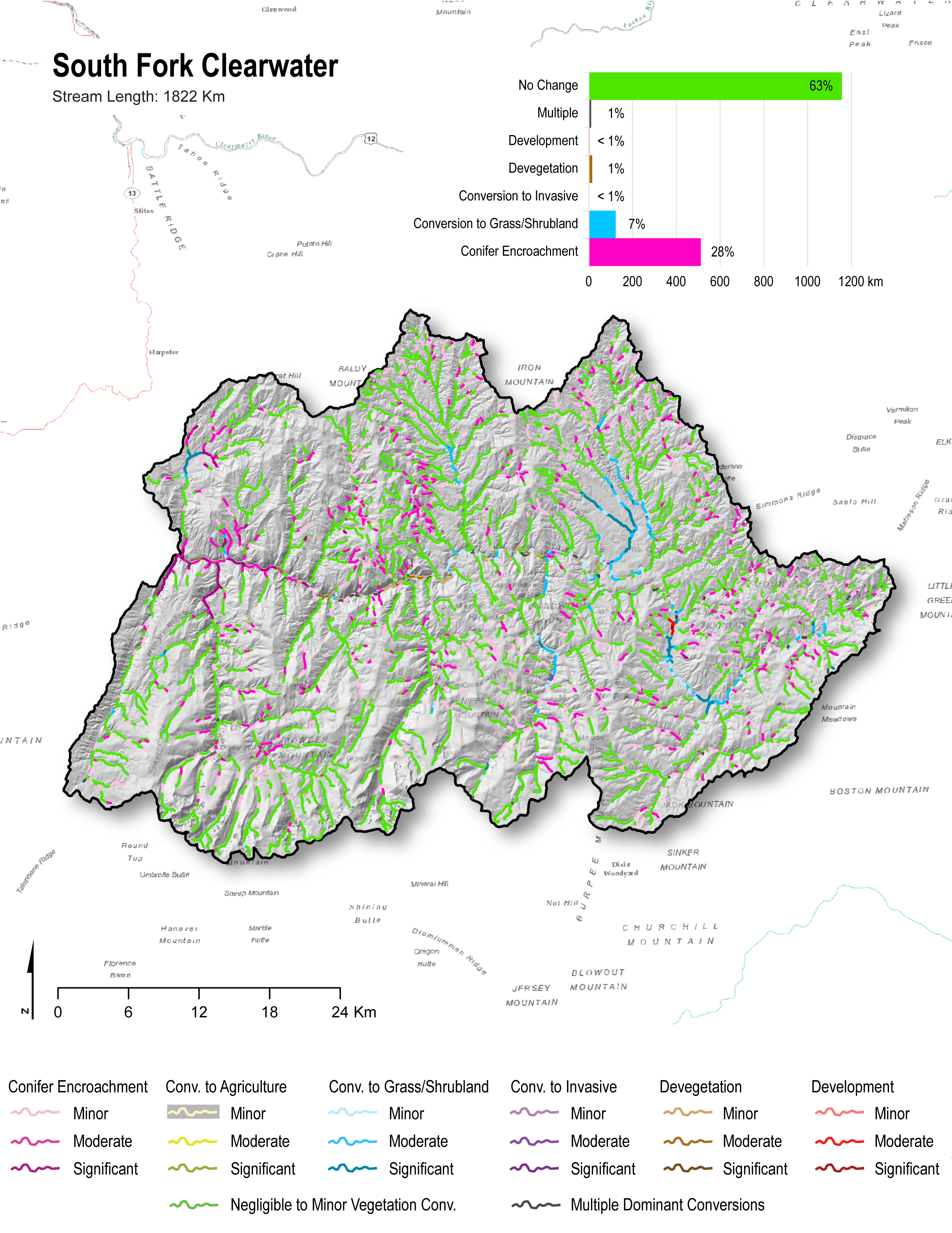
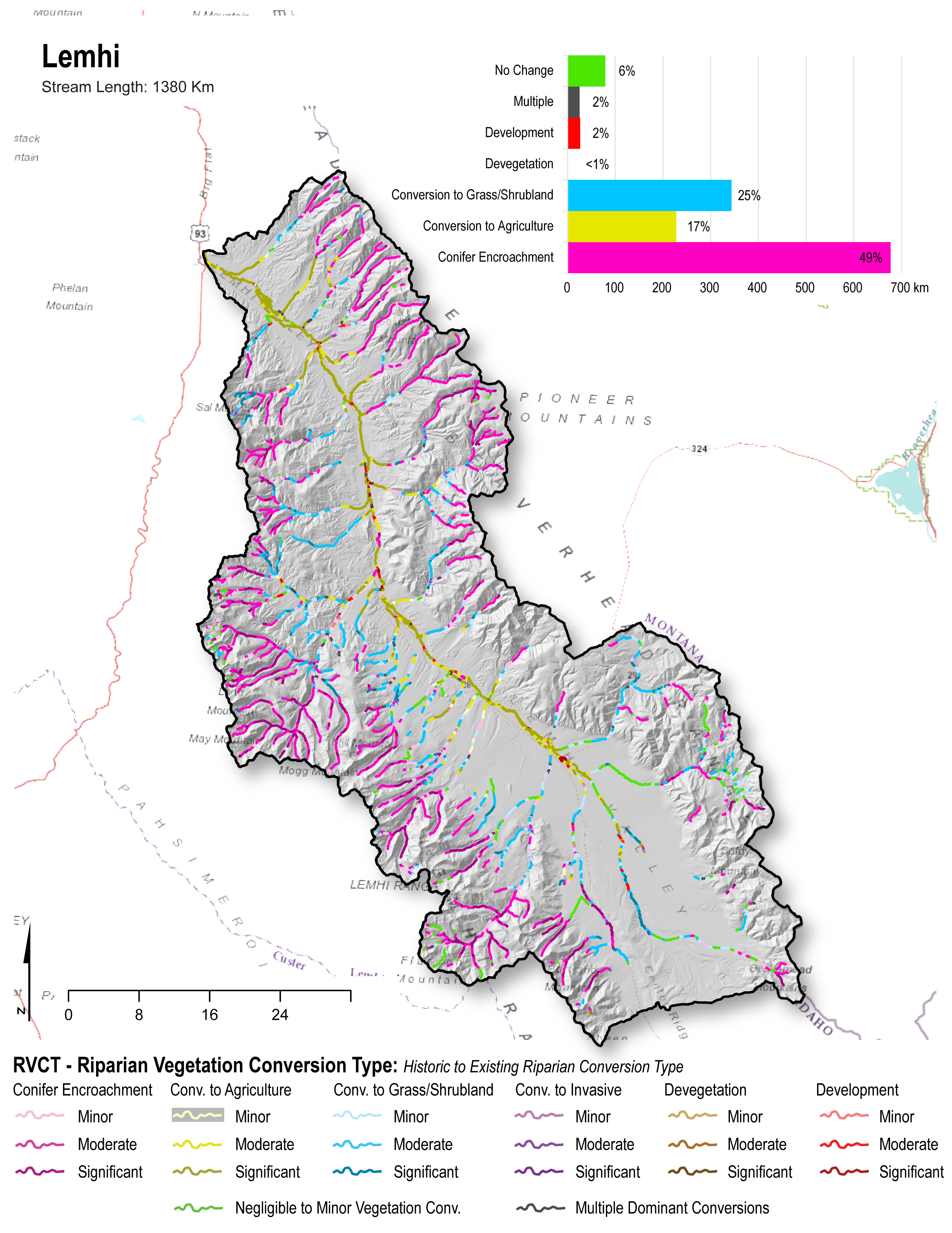
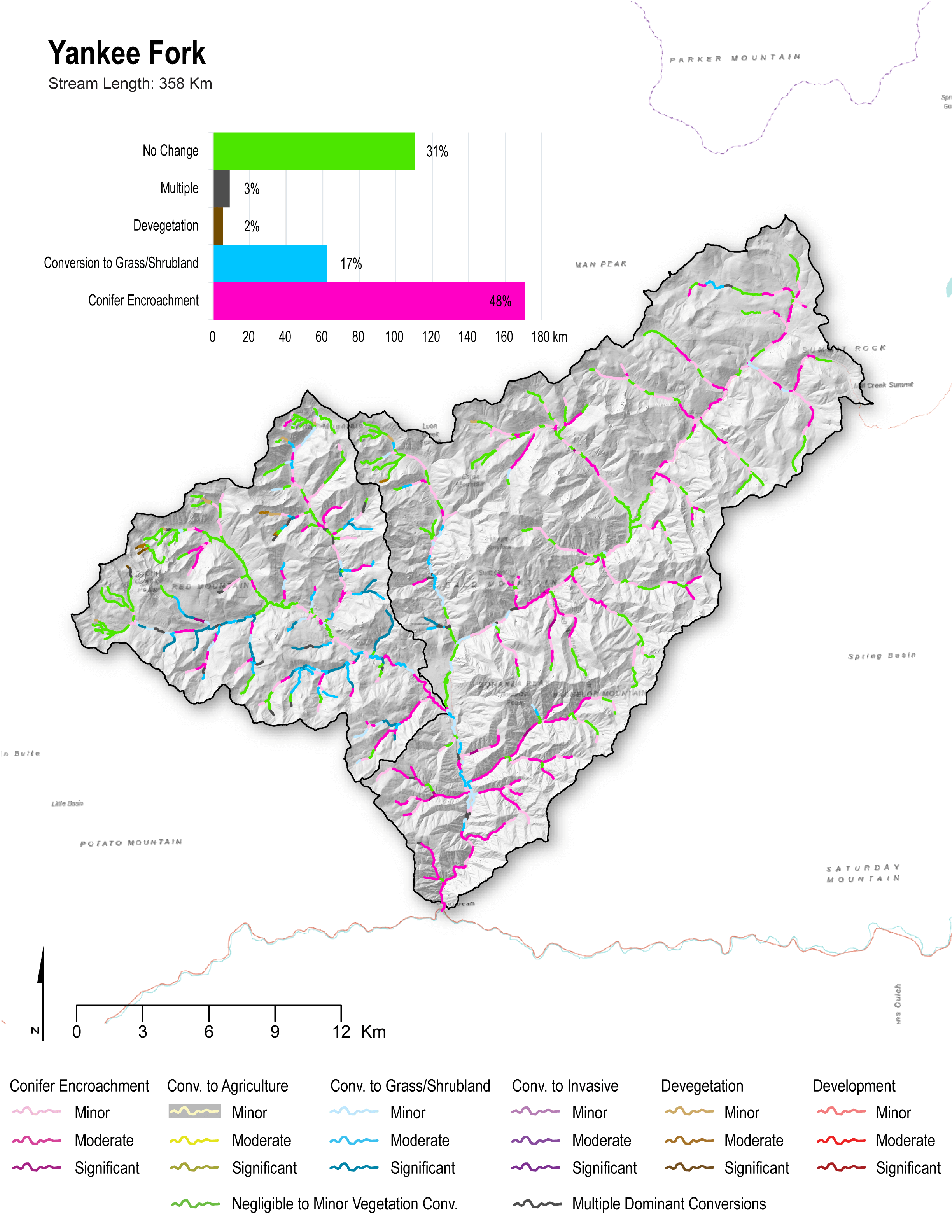
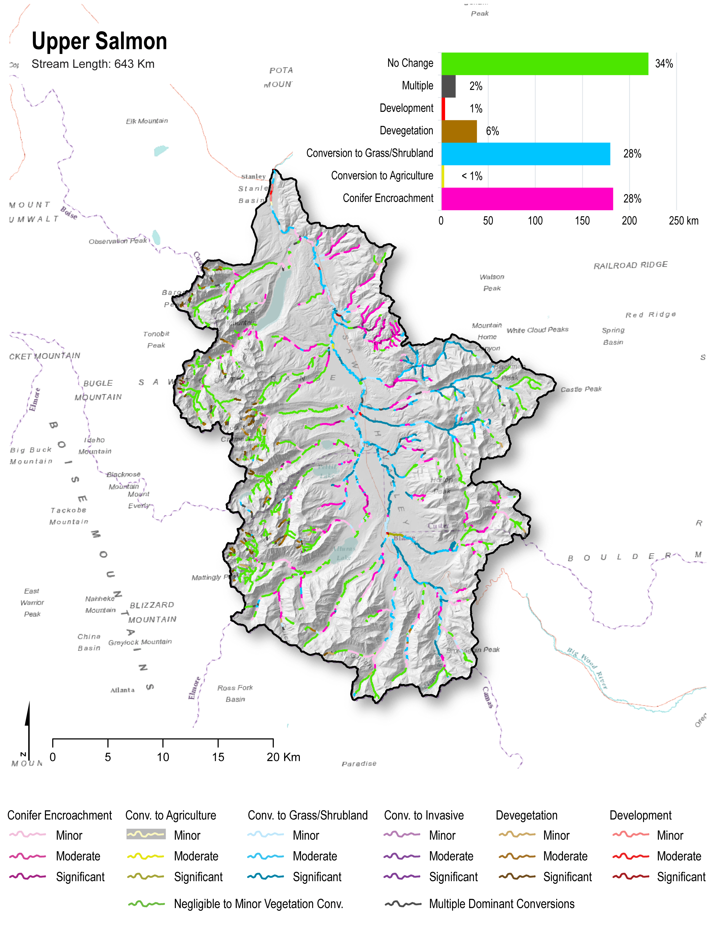
This page contains static map images for all of the data products produced using R-CAT for the Columbia River Basin (CRB). The watersheds assessed include the John Day and Upper Grand Ronde, Oregon, the Tucannon, Entiat, Wenatchee, and Asotin in Washington, and the Upper Salmon, Yankee Fork, Lemhi, Lochsa, Lower Clearwater, and South Fork Clearwater, Idaho (totaling ≈27,565 km of streams). Click on individual maps to enlarge, or navigate to the bottom of the page to download full resolution map collections.

Atlas By R-CAT Output Type

Area of Analysis

CRB_studyarea2

Riparian Vegetation Departure (RVD)

Wenatchee_RVD_website_8_16

entiat_RVD_website

TucannonRVD_fullextent

Asotin_RVD_website

LCW_Lolo_RVD

Lochsa_RVD_website

SFCW_RVD_website

Lemhi_RVD_website_12_16

YF_RVD_webmap

Upper_salmon_RVD_webmap

John_day_RVD_website

UGR_RVD_website

Riparian Vegetation Conversion Type (RVCT)

Wenatchee_RVCT_website_12_16

entiat_RVCT_website10

TucannonRVCT_12_16

Asotin_RVCT_website_12_16

LCWandLolo_RVCT_12_16

Lochsa_RVCT_website_12_16

SFCW_RVCT_webmap_12_16

Lemhi_RVCT_website_12_16

YF_RVCT_webmap_12_16

Upper_Salmon_RVCT_website_12_16

John_day_RVCT_12_16

UGR__RVCT_12_16

Riparian Condition Assessment (RCA)

Wenatchee_RCA_website_12_16

entiat_RCA_website_12_16

Tucannon_RCA_12_16

Asotin_RCA_website_12_16

LCWandLolo_RCA_12_16

Lochsa_RCA_website_12_16

SFCW_RCA_webmap_12_16

Lemhi_RCA_website_12_16

YF_RCA_webmap_12_16

Upper_Salmon_RCA_website_12_16

John_day_RCA_12_16

UGR__RCA_12_16